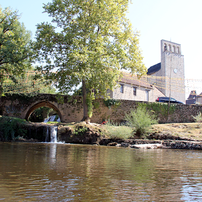
Showing posts with label Perigord. Show all posts

Sunday, August 8, 2021

Coly valley hikes: Salignac-Eyvigues.

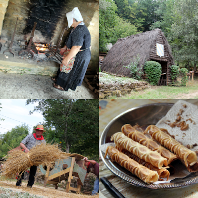
Medieval festivals at the historic village.
Located right on the edge of the Coly watershed, Salignac commands a strategic position descending towards the Vézère river and the Borrèze valley which descends towards the Dordogne river on the other side. First mention of a castle dates back to the turn of the millennium. Typically enough the original wooden structures start to be replaced by stone buildings in the 11th and 12th centuries, to which date back the two dungeons of the Salignac castle.
Medieval festivals at the historic village.
The Salignac family is a likely branch of the Viscounts of Turenne. Located on the border of the vicomté de Turenne, the Causse de Martel and the wooded hillsides of Périgord, the village of Salignac is a place of passage between Quercy, Limousin and Périgord. 
Local producers at the Marché gourmand nocturne.
Summer highlights are its popular medieval festivals at the historic village, its events around the farmers market (Tuesday mornings) and Marché gourmand nocturne (Friday evenings) on the Place du champ de Mars (market square).
Map of Salignac-Eyvigues.
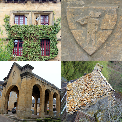
A walk around the village (promenade du bourg) takes a hour and passes Salignac Castle (1), the 17thcentury Halle and Hôtel noble des Croisiers (2), Eglise Saint Julien (3), village historique (4), a couple of lavoir (5), Market square (6).
Promenade du bourg.
Promenade du bourg.
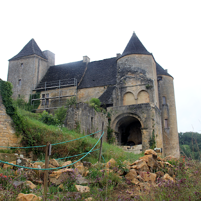
The Salignac Castle has seen a lot of historic changes, reaching its height in the 15thcentury after which it slowly decayed. The castle suffered damages during the Hundered Years War and the Wars of Religion. During the French Revolution villagers took over the castle, broken up and sold. By 1910 the main building and guardhouse were still standing. By 1912 the Salignac family bought back the castle and turned the remains into a stately manor, leveling most of the ruins and guardhouse to create a garden around three terraces on different levels.
Unique opportunity to visit ‘a work in progress’.
The castle was abandoned again, and by 2006 found new owners that set-out on a multi- generational journey to restore this historic monument. They worked 15 years to stabilize the site, replace structural beams and redo the ‘lauze’ roof. In 2021, 30 years after its last inhabitants left, the castle reopened its doors to the public. A visit gives you the unique opportunity to visit ‘a work in progress’. 
Restored room with its ‘pisé’ floor.
Much of the terraces are currently excavated, which allows for a sneak-peak under the surface. The spiral staircase provides access to the basement cut out from the rock, a room ‘left as they found it’, the central part currently under renovation, as well as a restored room with its ‘pisé’ floor and historic decor. Find out more about the landscape, history, vegetation, the villages and life on the causse:

 The index of this blog.

Sunday, June 27, 2021

The Coly stream

Source of the Coly at the watermill of La Doux.
Currently the source of the Coly is found at the watermill of La Doux close to La Cassagne. Previously it was located close to Saint Amand de Coly, but as legend has it a local farmer, whilst he was ploughing a field, could just save his life (and that of his oxen) when the new source opened up and started to spray out water. The 10-meter deep well has since attracted much attention, between 1965 when the first serious exploration took place and the 1980s when researchers managed to explore the underground river for 3 kilometers. In 1991 they passed the 4-kilometer mark (which was a world record at the time) and in 2003 they managed 5,880 meters.
'Water is life'.
'Water is life'.
From its source at the La Douce watermill the Coly drops 40 meters over its 10 kilometers length before it falls into the Vézère river at Condat-sur-Vézère. The natural series of cascades has long providing power to a series of mills. The 1889 annals recommend it for its fish; raving about the trout, salmon and chub (Le chevesne, locally know as le cabot – Squalius cephalus) a kind of carp.
'Water is life'.
'Water is life'.
Today fishing is regulated and allowed in season and by permit only. Most common fish species are the minnow (Le vairon), bullhead (Le chabot), gudgeon (Le goujon), brown trout (La truite fario), northern pike (Le brochet). Rare are crayfish and brook lamprey (Le lamproie) a weird primitive 'jawless fish’.
'Water is life'.
'Water is life'.
On the waters edge you find water loving tree species like the Alder (Alnus glutinosa), Ash (Fraxinus excelsior), Willows (Salix sp.), European oak (Quercus robur), Black poplar (Populus nigra nigra), Lombardy Poplar (Populus nigra italica), other varieties of Poplar introduced for the production of wood (Populus x euramericana) as well as field Elm (Ulmus minor). With an undergrowth of Elder (Sambucus nigra), Hawthorn (Crategus monogyna), Spindle (Euonymus europaeus), Guelder-rose (Viburnum opulus) and common Dogwood (Cornus sanguinea). These linear forest form important ecological conduits in the landscape.
'Water is life'.
'Water is life'.
'Water is life', and hiking or cycling down the Coly you will be able to enjoy grasslands with Aquitaine and Limousine cattle, observe the dragonflies, damselflies and mayflies (only in may), kingfishers among many kinds of birds, aquatic plants, irises, narcissus and orchids…etc., on the banks. Find out more about the landscape, history, vegetation, the villages and life on the causse:

The index of this blog.

Friday, June 18, 2021

Introduction to the landscape: Prehistory

Lascaux cave paintings.

Lascaux cave paintings.

We have learned nothing in twelve thousand years’

Picasso might have exclaimed this at exiting the Lascaux cave (though it might have been: ‘We have invented nothing …’, or perhaps exiting the Altamira cave in Spain, there is no evidence for any of them). Bahn (2005) reveals Picasso’s limited interest in Ice Age art, he did own a reproduction of the Venus of Lespugue. His insight into the distorted ideas we have about early humans due to the ephemeral seems very valid:

Je ne crois pas me tromper en affirmant que les plus beaux objets de l’âge de, “pierre” étaient en peau, en tissu et surtout en bois. L’âge de “pierre” devrait s’appeler l’Age de bois.…’. *
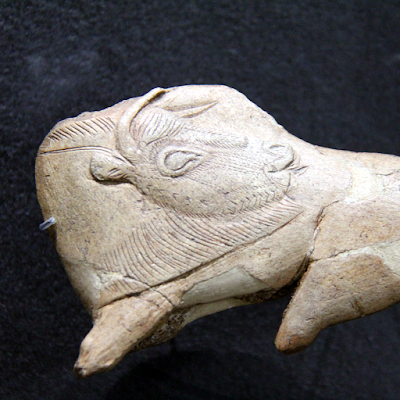
Bison licking its side from the Madeleine shelter on display at the National Museum of prehistory in  les Eyzies.

Bison licking its side from the Madeleine shelter on display at the National Museum of prehistory.

The ‘Vézère valley ensemble’ of 147 prehistoric sites and 25 decorated caves, is now (as a landscape) classified UNESCO World Heritage site. The UNESCO states that: ‘The objects and the works of art found in the Vézère Valley are extremely rare witnesses of long extinct civilizations, which are very difficult to understand’. And that ‘by their chronology (from 400.000 to 10.000 years), these sites reflect the diversity of human occupations and artistic productions of prehistoric humankind. The essential of the sites is conserved in the state in which they were discovered, ensuring their authenticity’.
Map of Ice Age Europe, with prehistoric sites.

Map of Ice Age Europe, with prehistoric sites.

Much of the ‘outstanding universal value for humankind’ of this ‘dead-end migration route’ lies in the coherence of what was left behind. The landscape guided human and animal migration routes (reindeer and salmon) following rivers and cliffs, providing shelters and caves at a time the global human population was below 5 million. The Ice Age landscape looked very different, lower sea levels meant the continent, the British Isles and possibly on to present day Iceland) were one vast brush tundra supporting herds of bison, aurochs, horses, mammoth, woolly rhinoceros and giant deer. Much (most) of the cultural remnants lie at the bottom of the sea, or have rotten away. The entrance to the decorated Cosquer cave was discovered at 36 meter below current water level of the Mediterranean. The sites of the Vézère valley were relatively accessible and relatively undisturbed.
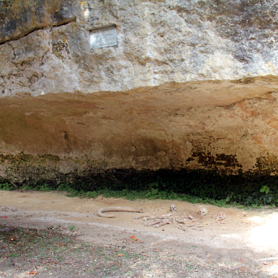
The Cro-Magnon rock shelter with reproduced skeletons.

The Cro-Magnon rock shelter with reproduced skeletons.

Undisturbed that was, till 1868 when the construction of the Périgueux-Agen railway line uncovered animal bones, flint tools, and human skulls in the Cro-Magnon rock shelter (abri) at Les Eyzies. French geologist Louis Lartet was called for excavations, and found the partial skeletons of four prehistoric adults and one infant, along with perforated shells used as ornaments, an object made from ivory, and worked reindeer antler. The discovery shocked the common understanding of human history and forced a re-think. 27,500 Years ago, people that shared modern anatomical characteristics, buried their dead carefully and left accompanying ‘offerings’.
Laugerie-Haute (24,000 – 14,000 BC) with its 10.000 year unbroken historic record.

Laugerie-Haute (24,000 – 14,000 BC) with its 10.000 year unbroken historic record.

The discovery led to a frenzy of treasure hunting excavations that turned up a series of shelters: Le Moustier, La Micoque, La Ferrassie, Shelter of the Fish, The Cap Blanc Shelter, all pieces of a puzzle that only fell in place with the excavation of the Laugerie-Haute (24,000 – 14,000 BC) with its 10.000 year unbroken record of bone tools, art objects and an abundant series of carved flint. Interestingly a travel industry developed around the pre-historic sites and caves, so conveniently located on the railway. Reading the accounts and advertisement up till the turn of the century leaves you wandering why there is no reference to the paintings? Interestingly enough no one saw them, visitors carved their names right across them at the Font-de-Gaume Cave without noticing.
Entrance to the Font de Gaume, les Combarelles, Abri du Cap-Blanc and Bernifal.

Entrance to the Font de Gaume, les Combarelles, Abri du Cap-Blanc and Bernifal.

The 1878 third Paris World's Fair displayed Vézère Valley objects that attracted the fascination of a certain Mr. Sautuola. He decided to try his luck in some of the local caves on returning to Spain. Bringing his daughter along to hold the light, she first saw the figures on the ceiling of the cave (he had been scouring the floor for objects). In 1880 Sautuola published ‘his’ find, linking the drawings to the Paleolithic Period. Again shock, disbelieve and skepticism from incredulous prehistorians from evolutionist or creationist perspectives a like. They had to be fake… they were not recognized until 1902, after the discovery of Paleolithic rock art in caves like Combarelles and Font de Gaume had validated the idea.
Mammoth at the entrance to the Rouffignac cave.

Mammoth at the entrance to the Rouffignac cave.

By the end of the 19th century the Vézère valley became known as the 'Valley of Mankind’. The discoveries made through haphazard excavation of prehistoric sites fed the euro-centrist (and ‘scientifically’ racist) world view that creativity and intelligence must have originated in Europe. Discoveries around the word** have since affirmed these qualities to be essentially human and ‘we’ carried them with us from Africa (with the African rift valleys now the ‘cradle of mankind’). The irrelevance was confirmed further when DNA research revealed little continuity between these early and present day Europeans, and now even Cheddar Man’seems to have had dark skin… we have learned little indeed ... still the same small tribal mindset. A more detailed introduction of Cave Art and some of the sites will be the subject of another post.

References:
*) ‘I do not think I am mistaken in saying that the most beautiful objects of the “Stone Age” were made of skin, fabric and especially wood. The "Stone" Age should be called the Wood Age’ …
As quoted in Bahn P., 2005. A Lot of Bull? Pablo Picasso and Ice Age cave art In:Munibe. Antropologia-arkeologia. 2005, Num 57, pp 217-223.
 

**) For some recent examples see: Tens of Thousands of 12,000-Year-Old Rock Paintings Found in Colombia and 45,000-Year-OldPig Painting in Indonesia May Be Oldest Known Animal Art

Saturday, June 12, 2021

Introduction to the landscape

‘Le gout des vieilles pierres’, story telling on a walk through Saint-Geniès.
Le gout des vieilles pierres’, story telling on a walk through Saint-Geniès.
Je suis un paysane, je vis dans mon pays, je façonne le paysage, et le paysage me façonne’.

Words spoken by storyteller Clément Bouscarel on a spring evening walk around Saint-Genies. Though his Occitane had a Quercy flavor to it, it hardly mattered as few people on the tour could make much sense out of the rolling R’s and vaguely Italian or Spanish echoing sentences.
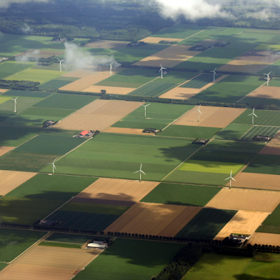
A flat, functional and rationally controlled landscape, the Netherlands.
A landscape (paysage) is a spatial record of past and present activities and interactions of natural and cultural forces into a unified whole. The word 'landscape' can be traced to Germanic languages of the 12th century and was used to refer to inhabitants of a region. It covered the shape of the land, the customs of the people and the material forms generated by these customs as well as the immaterial laws and organizations.
The bright city lights: Three dimensional, free market, 24 hour economy, Hong Kong.
The landscape is not just a product of nature; climate, relief, soil, flora and fauna. But also a product of people; their (un)intentional interventions. The landscape is a product of organizational (political), material (economic), technological (knowledge), cultural (perceptions) and natural forces. The landscape is not just matter but also a product of the mind. We perceive the face of the earth and interpret the scenery. We can ‘read’ landscapes through our own experience and that of our shared cultural memory.
The red soils and dry high forests of the Togo hills, Ghana.
As people grow-up in a landscape they often get attached to it (benchmark) and derive part of their identity from it. Landscapes are ephemeral: Ephemera are things people collect such as old postcards, posters and bus tickets, which were only intended to last a short time when they were produced (or for a particular function). The ephemeral manifest itself in the landscape in Temporarily Obsolete Abandoned Derelict Sites (TOADS), edgelands that have lost their function and have not yet found a new one. Landscapes ought to survive us so we can revisit the landscape of our youth, but the landscape of our youth might not even survive our youth (You can’t go home no more).
‘France may one day exist no more, but the Dordogne will live on just as dreams live on and nourish the souls of men’.
France may one day exist no more, but the Dordogne will live on just as dreams live on and nourish the souls of men’.
Regretting fast and large scale changes, what conservationists want to conserve at any given time is the status quo at a particular point between one set of human interventions and another – residue of yesterday’s ‘progress’ after it had acquired ‘patina’ a ‘feel of naturalness’ or ‘tradition’. People made changes to the landscape and have impacted on the environment where ever and whenever they appeared. New is the awareness of the change and the pride/shame it gives, the landscape became a product of people, and the people a product of the landscape. Find out more about the landscape, history, vegetation, the villages and life on the causse:

The index of this blog.

Saturday, June 5, 2021

Forests of the Périgord: ‘A peasant forest’.

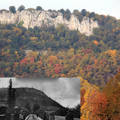
Autumn colors the forest today and same area on 1910 postcard.
Humans have shaped the landscape for centuries to suit their needs and way of life. As late as 2001 the Périgordian forest was caricatured as: ‘Une forêt privée, morcelée, essentiellement paysanne.’, resonating 1970’s government’s concerns about the ‘lack of a forestry spirit’. ‘Peasants hardly think to maintain forests’, ‘bear little interest in it’, see it as ‘part of landscape’ but do not tread it like a ‘real resource’.
Oak is great for firewood and fencing poles.
The forest continued to provide the litter and nourishment for a flocks of pigs (acorns), firewood, lumber and materials for building and agricultural uses like fencing poles and stakes. It continues to support hunter-gather attitudes: hunting for deer and wild boar, picking mushrooms, gathering truffles. It is a relatively liquid source of cash: wood harvested or the sale of a parcel allows for the purchase of agricultural equipment and helps to keep afloat deficit agricultural holdings.
The forest provides berries, nuts and mushrooms.
The Dordogne department might be characterized as ‘forested’ (about half the land area is under forest cover), but hardly supports any ‘forestry’. With over a 100,000 forest owners, 99% of the forest of the department belongs to natural persons (not corporations), resulting in an average size of less than four hectares per owner. There are only 3 very large properties (> 400 ha). This fragmentation is the result of sharing inheritances and the sale of small plots to city dwellers for whom it is a ‘privileged natural environment’.
The forge at Savignac-Ledrier.
Ruins of (pre)industrial forges dot the landscape. These often used streams to power the high furnish blower and charcoal as fuel. Operated during the winter season, they made use of surplus agriculture labor. The introduction of (fossil) coal to power and fuel larger industries that would produce permanently, moved production towards the north. As a result charcoal production halted, and forests just grew.
Half the land under forest, but hardly any ‘forestry’.
The Périgord landscape is now more forested (thicker and more closed) than ever in recorded history. This closure occurred at the expense of ‘marginal spaces’ that were neglected or fell prey to the utilitarian productivity drive of the 1960s/70s, to give ‘marginal’ or ‘wastelands’ new uses (‘waste’ as in ‘wasted’ because not optimally used). Compartmentalization of management (specialized forestry and agriculture departments), and even within agriculture a move away of ‘mixed holdings’ combining animal husbandry and cultivation.
Very different forest-types found at close distance.
Paradoxically this increase in forest cover supports lesser biodiversity due to a decreased in the diversity of forest structures. This has also an effect on the fauna Animals preferring open vegetation types (like the hare) decrease, whiles forest species (like deer) increase. Find out more about the landscape, history, vegetation, the villages and life on the causse:

The index of this blog.

Monday, May 31, 2021

Coly valley hikes

Poppies in a field.
Poppies in a field.
Just to the South of Terrasson, the Coly stream cuts through steep hills with a remarkable geology: Jurassic formations to the north and Cretaceous to the south. Small streams drains the 170 km<2 watershed covered with undulated forestland, scattered with rich agricultural valleys, grasslands (pelouse), walnut groves, villages and small hamlets.
Map of the Coly watershed with hiking trails.
Villages include Saint Amand de Coly; classified as one of France’s most beautiful villages. And the hamlet of Chapelle Mouret; protected Architectural, Urban and Landscape Heritage Protection Zone (ZPPAUP - Zone de Protection du Patrimoine Architectural, Urbain et Paysager).
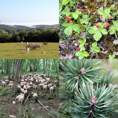
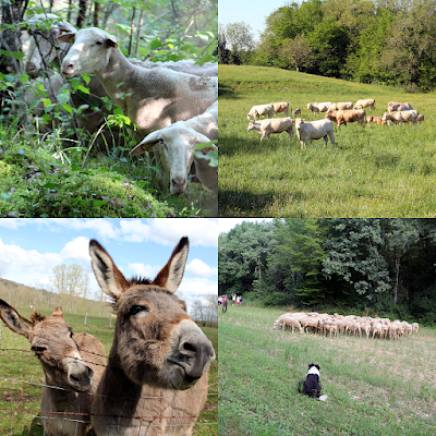
Rich fauna of the varied landscape.
The Causse de Terrasson is a large natural area of ecological interest (ZNIEFF: Zone Naturelle d'Intérêt Ecologique, Faunistique et Floristique) encompassing representative environments of the Périgordian causses: to the north the hills are covered with a mosaic of pubescent oak forests, juniper heaths and lean grasslands. To the south forest of chestnuts and hornbeam.
Extensive grazing keeps the landscape open.
The Coly stream falls into the Vézère at Condat-sur-Vézère, once the principal seat of the Hospitallers with dependencies in La Cassagne and Ladornac. Upstream, the Chironde tributary supports a series of watermills, on its upper reaches the village of Saint Geniès with its remarkable concentration of vernacular architecture and its typical lauze (dry stacked natural stone) roofs.
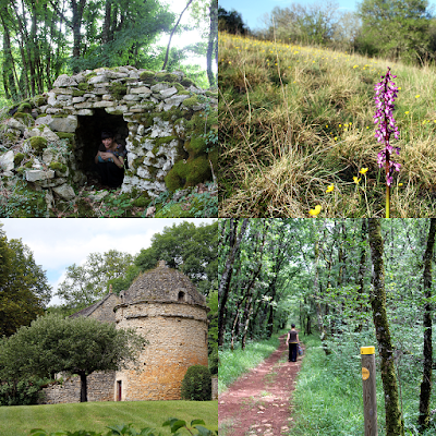
Vernacular heritage dots the landscape.
A large number of hikes and walks allow for the active exploration of this varied landscape. Every season has something different to offer, from the wild orchids of spring to the colors of autumn, many activities in summer; including the transhumance and cultural events in Saint Amand de Coly. And the black Périgord truffle harvest and markets of winter.
Varied vegetation and small cultural heritage along the hiking trials.
Find out more about the landscape, history, vegetation, the villages and life on the causse:

The index of this blog.

Saturday, May 22, 2021

Coly valley hikes: La Dornac

The three saints: Sore, Amand and Cyprien.
La Dornac (officially but also known as Ladornac), is a small rural community that is part of the communauté de communes of Terrasson. Population peaked in 1830’s at around 1000 inhabitants, dipped to 250 in the 1980’s, and has since increased to 400. This increase is mostly due to its position in the aire d'attraction de Brive-la-Gaillarde. The shift from agricultural (wine) production to a commute village is most notable in the bourg, which in 1830’s had 200 inhabitants but today only supports 20. Despite the small population a ‘multiple rural’ serves as bread depot and bar-restaurant with a terrace.
The Notre-Dame Church.
The bourg is small but has an interesting cluster of buildings surrounding the Notre-Dame Church (1), once the seat of a preceptory of the knights Hospitallers. Built on a steep slope in a number of phases. The paneled rectangular nave was added to the 12th century vaulted choir which supports the 3-levels defense tower. The keep had breteches and hoards allegedly strong enough to refuse to receive Bertran de Goth, future Pope Clement in 1304.
Map of la Dornac.
Map of la Dornac's sentier d’interprétation.
To the north side of the nave a smaller chapel covered with a lauze roof and, to the south, a large rectangular Gothic chapel were added in the 16th century. The capitals are carved with interlacing, foliage and figures. The bands of Caroligian tradition on two of them are reminiscent of Romanesque art from the second half of the 12th century. A belfry-wall, to the west, dominates a portal with three broken arches.
BBQ at the hall after the transhumance.

BBQ at the hall after the transhumance.

The main attraction of la Dornac is its access to the surrounding Causse Terrassonnais through a number of hiking trails. To walk the 2,5km sentier d’interprétation pick-up the booklet at the bar-restaurant. Or walk the 9,6 Boucle de St.Chaubrant (also known as Des bois et des pierres indicated in yellow), the 10km Orchidées sauvages et petit patrimoine (indicated in blue), or the 16 km ‘A la dcouverte de la faune et la flore sauvage’ (indicated in red). The walks are exploring the natural and cultural heritage dotting the landscape including the drystacked walls and cabanes reminders of wine cultivation, the truffires (2) and traces left by the charcoal makers (charbonnières). Bring a pick-nick to the cabane de la Louise (3) or other dedicated pick-nick areas along the trails.
Le site des orchidées sauvages.

Le site des orchidées sauvages.

If you happen to be in the area during the spring (April-June) a visit to the wild orchid site (4) is a must. Local enthusiast Josiane Glaudon updates the indicators on the side, and will guide on request. An information panel does help the individual visitor. Please be careful not to step on the orchids, and do not gather flowers or plants. The community organizes or participates in activities throughout summer often using the community hall(5) to welcome and shield participants. Find out more about the landscape, history, vegetation, the villages and life on the causse:

The index of this blog.

Saturday, May 15, 2021

Coly valley hikes: Saint-Geniès

Ensemble of beautifully restored local stone buildings and lauze roofs.
Typical village located in the heart of the Périgord Noir, Saint Genies is located on the Chironde, a tributary of the Coly. Of the XIIth century castle only a vestiges of the dungeon (2) remain. The village is renowned for the important architectural ensemble of beautifully restored local stone buildings and lauze roofs. On the central square a market is held every Sunday morning, in July and August, the Wednesday night market allows you to buy and consume on the spot. From December to February the Sunday morning truffle market brings together local producers.
In July and August, the night market allows you to buy and consume on the spot.
In 1200 the village is acquired by Boson de Salignac and mention of the lordship of Saint Genies appears towards 1282. In 1327 the co-lords of Val, Salignac and Saint Genies authorizes Gaubert de la Caminade to build the Cheylard chapel. The date the original castle was destroyed is unknown, the current castle (1) dates from the XVIth century, when several houses (elements of the XIIIth century) were united.
The XIVth century frescoes are of particular interest.
From the Romanesque XIIth century church of Notre Dame de l’Assomption (1) only the apse remains. The side chapels date from the XIII, XV, and XVIth centuries, the bell tower near the end of the XVth century . The church was devastated during the wars of religion. The chapel of Cheylard (or Saint Catherine chapel) (3) has survived in its original form, its XIVth century frescoes are of particular interest. It was recognized as a historical monuments in 1899. The middle section of the north wall depicts Saint Thomas Becket (Archbishop of Canterbury between 1162 and 1170), a popular saint in the Périgord and Limousin during the Angevine (‘English’) empire.
A 'dynasty' of lauzier masters, classified as an UNESCO Intangible Cultural Heritage.
Saint Genies has an exceptional heritage of lauze roofs, thanks to a 'dynasty' of lauzier masters. Classified as an UNESCO Intangible Cultural Heritage (ICP) Mr.Chapoulie is also responsible for the upkeep of beautiful Perigord Noir castles like Castelnaud, Fenelon, Marqueyssac and even roofed the Maison de la Sirène in Collonges-la-Rouge, Corrèze. The lauzes are between 2 and 6 cm thick and weight between 500 and 800 kg per m2, so a solid oak frame with chestnut slats is needed. When restored, a roof is first 'rissonnee' (hedgehogged) to check and clean the existing stone.Then redone from bottom to top on a 'bench'.
Map of Saint Geniès.
Saint Geniès is at the start of a number of hikes, the 50 minutes Promenade the bourg offers some great views, whiles the 11/15 km Boucle du Sireyjol et de la Chironde explores the Watermills and small cultural heritage like the lavoir (4), former railway station (5) and pigeon-towers (especially recommended during the European Mill days and National Heritage Weekend when mills are open for visits). Other options are the 15.5km Boucle Pierres et Lauzes, the 7,7km Boucle des Moulins, 7,7km Boucle des Etangs and the 15,4km Boucle des Combes. Find out more about the landscape, history, vegetation, the villages and life on the causse:

The index of this blog.

Friday, May 7, 2021

Coly valley hikes: Condat-sur-Vézère

Condat on confluence of the Vézère and Coly
Condat on confluence of the Vézère and Coly.
The name Condat derives from the gallic word 'condate', meaning 'confluence of two rivers', in this case the Vézère and the Coly. The first writings evoking Condat go back to the Middle Ages. Today the village is known as Condat-sur-Vézère (occitan Condat de Vesera) to avoid confusion as the name is 'Condat' is quite common.
Condat during its festivities.
Condat was occupied by the Order of Knights of the Hospital of Saint John of Jerusalem (also known as Knights Hospitalier or Hospitallers for short) from the 12th till the 18th century. After the conquest of Jerusalem in 1099 during the first crusade, the organization became a religious and military order charged with the care and defense of the Holy Land. Pope Clement V dissolved the rival order, the Knights Templar, in 1312 and turned over much of their property to the Hospitallers.
Map of Condat-sur-Vézère.
The village was the seat of the principal commanderie of the Hospitallers which had authority over a genuine network of commanderies of the Périgord. The commanders had the right on high and low justice and his authority was exercised over the many possessions in Périgord. From 1291 to 1790, thirty commanders succeeded one another in Condat. During the wars of religion the parish of Condat was devastated several times.
Romanesque church of Notre-Dame-et-Saint-Jean-Baptiste.

Romanesque church of Notre-Dame-et-Saint-Jean-Baptiste.

The commanderie of Condat has conserved the majority of the buildings as they were (re)constructed under the command of François de Touchboeuf Clermont by 1540. The small watermill (1), large watermill with the common bread oven (2) (four banal), the church (3), prison (4), commanders lodge (5), noble house of Verdier (6), remnants of the ancient enclosure wall (7) and fishponds. The Hospitallers exploited the hydrolic power of the Coly through mills to work grain, nuts and hemp though this last 'fulling mill' has today disappeared.
The 14th century prison tower.
From the Castle of Condat, the 16th century lodge remains and the 14th century prison tower, registered as historical monuments since 1948. The rectangular building has an adjacent square on one side, fishpond and ramparts on the other, and in the opposite corner a 16th century tower. The Romanesque church of Notre-Dame-et-Saint-Jean-Baptiste, dates back to the 12th century with its fortified flat bell tower with four bays, that is accessible through a staircase in the right buttress. The old residences include the noble house of the Verdier and some half-timbered (à colombage) houses (8).
Transhumance passing through the village.
The four banal (commune oven) is a reminder of the restrictions in feudal tenure in France which obliged peasants to use the facilities of their lords, until the 18th century. These included the required use-for-payment of the lord's mill to grind grain, his wine press to make wine, and his oven to bake bread. Both the manorial lord's right to these dues and the banality-dues themselves are called droit de banalité. The object of this right was qualified as 'banal', e.g. the four banal.
Hiking the Boucle de Maurival.
You can walk around Condat in 30 minutes or hike one of the following trails: Boucle de la Commanderie; 9km – 3h, Boucle du Pech; 2,7km – 1h and, Boucle de Maurival; 11,6km – 3h. Find out more about the landscape, history, vegetation, the villages and life on the causse:

The index of this blog.

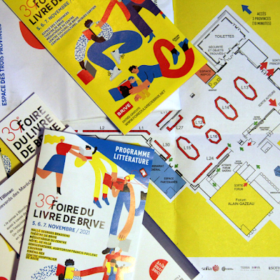
The Foire du livre de Brive and the École de Brive.

The posters,bookmarks and leaflets were reprinted, the stickers had a whiff of ‘country’ this year. ‘ Ce qui nous unit tous les cinq n’est...