Saturday, July 31, 2021

La Vicomté de Turenne: Autoire.

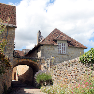
Autoire deserves its “Plus Beaux Villages de France” label.
In descending from the plateau by the precipices that edge them, one is suddenly transported from parched wastes to pleasant pastures... Above, on that stone table, are wind, cold, nakedness, poverty, moroseness, hideousness, - a void, for few villages are found aloft; below, orchard land, warmth, gaiety, abundance. The startling contrast between some of the cañons and their causses forms one of the most phenomenal beauties of beautiful France.

Wrote Sabine Baring-Gould (an Anglican priest, antiquarian, novelist, folk song collector and eclectic scholar), in his 1894 book: The deserts of Southern France: an introduction to the limestone and chalk plateaux of ancient Aquitaine. He found the causses to be ‘veritable deserts: in winter a Siberia; in summer a Sahara…’
Nestled at the bottom of the forested valley is the village of Autoire.
A year earlier (1893), compatriot Edward Harrison Barker, wrote in his book; Wanderings by southern waters: Eastern Aquitaine, after taking his ‘sheep-track up the arid steeps’:

And yet, when I looked down into the bottom of this steep desert of stones, what soft and vernal beauty was there... just as if that strip of meadow, with its gently-gliding river, had been lifted out of an English dale and dropped into the midst of the sternest scenery of Southern France.
Autoire can be explored through small alleyways.
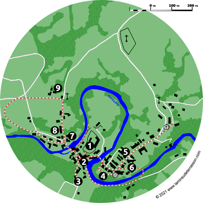
Sadly the ‘epoch when everyone travels’ is over, but the modern day tourist can nowhere experience the contrast between the plateau and the valley easier than by hiking the Autoire ‘cirque’ (circus) with its 150 to 200 m high limestone cliffs. Shaped by the Autoire stream, grinding its way into the limestone plateau of the Causse de Gramat through a 30 m high waterfall (7). Beautiful and impressive, this majestic waterfall is the first highlight on a 3 km (2 hour) walk. On your way to the waterfall, stop at the Chappelle Saint-Roch (6) and have a quick look at its frescoes through the grilled window.
The 30 m high waterfall.
From the waterfall a steep climb brings you to a viewing area (8) on the edge of the cliff with great panoramic views of the valley and waterfall. The hamlet of Siran is home to a farm managing a flock angora goats. The descend passes the Château des Anglais cliff-castle (9), a medieval construction enclosing a overhang in the limestone cliff. Long the home of ‘brigands’, it has commanding views and is naturally protected on all sides, a closer inspection reveals it is basically a facade, only two meters deep at the interior.
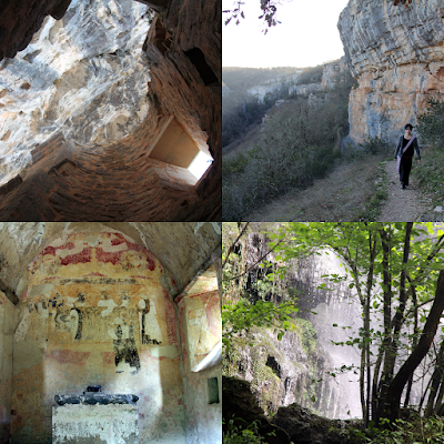
Hiking the Autoire ‘cirque’.
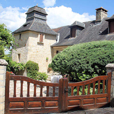
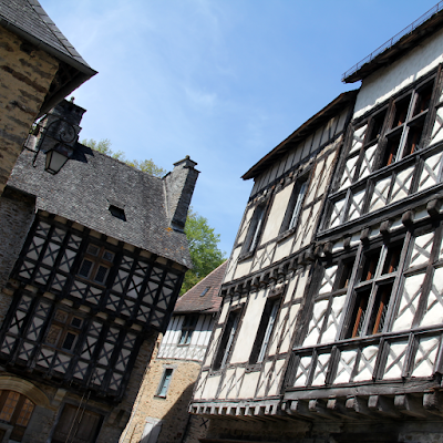
Nestled at the bottom of the forested valley is the village of Autoire with its elegant manor houses flanked by turrets, mansions, castles and half-timbered houses. The Romanesque church of Saint-Pierre et Saint-Paul (1) was rebuilt by the end of the 11th and beginning of the 12th centuries. It was fortified towards the end of the Hundred Years War, and the bell tower was raised. Covered with a cupola it has interesting sculpted decorations.
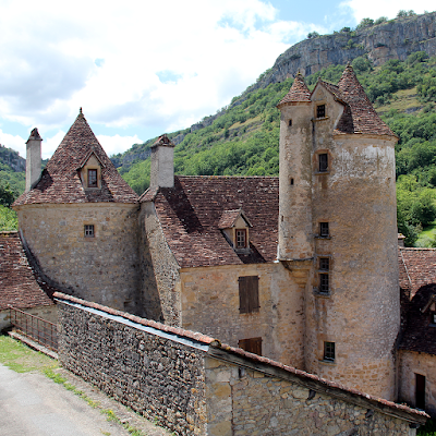
Elegant manor houses flanked by turrets, mansions, castles and half-timbered houses.
The Fontaine aux Dauphins (2) build by ‘voluntary contributions’ takes center stage, pass l’ancien couvent (3) and the Chateau de Limargue (4) that obtained the right to build towers and machicolations after its owner was knighted by King Charles VIII. The door at the bottom of the tower is adorned with a toric arch carved in an accolade, typical of the late 15th century. The second tower, more imposing, served as a defense tower.
Map of Autoire and its hike.
The Manoir de Laroque-Delpratas (5) deserve special mention; owned by a bourgeois family since 1605 (judges, notaries, lawyers), it preserves its 17th century characteristics: L-shaped plan, stairwell, large windows and decorated skylights. Small restaurants, and shops promoting local art and gastronomy, can be explored through small alleyways. Autoire deserves its “Plus Beaux Villages de France” label. Find out more about the landscape, history, vegetation, the villages and life on the causse:

 The index of this blog.

Monday, July 26, 2021

The Vézère Ardoise: Saint Robert

One of three fortified gateways of Saint Robert.
Strategically located at the top of a limestone plateau, the fortress, the ramparts and fortified towers of Saint Robert still impress today.
The pilgrimage church of Saint Robert with its apsidal chapels.
The pilgrimage church of Saint Robert (1) is at the center, a listed historic monument since 1862, and worth a visit. The Church was damaged and destroyed several times over the course of history, then rebuild with new additions.
Detail of the circulation gallery around the chancel.
At some time the nave was broken down, leaving an interesting cluster: the chancel, the ambulatory, transept and apsidal chapels (all 12th century), square towers and an octagonal lookout tower. An ambulatory (circulation gallery around the chancel), allowed pilgrims to kneel in front of relics kept in the apsidioles.
The panoramic view of the landscape from the rampart.
Make sure not to miss the garden in the left of the church down the stairs with a panoramic view of the landscape from the rampart (2).
Pigeon's loft along the village walk.
Pigeon's loft a[ong the village walk.
The village is build out of local limestone and a short walk passes a 16th century chapel (3), three fortified gateways (4), a pigeon's loft (5) back to the central place with its wrought iron cross full of symbolism (6), the Beauroire manor (7), ancient mansion (8) and the 12th century monastery (9).
Map of Saint Robert.
Find out more about the landscape, history, vegetation, the villages and life on the causse:

 The index of this blog.

Sunday, July 18, 2021

The Vézère Ardoise: Ségur-le-Château

Located in a loop of the Auvézère.
Located in a loop of the Auvézère, Ségur-le-Château is, as its name suggests, a secure place, that was chosen by the 9th century feudal Viscounts of Limoges to build a castle. The city of Ségur remained the seat of the Viscounts of Limoges for six hundred years. Though Ségur never was the actual capital of the Viscount the lords resided here regularly, attracting families of knights-vassals and a number of officers.
Beautiful group of 15th century half-timbered houses.
During the Hundred Years War, the fortress of Ségur was occupied by the English between 1361 and 1374, then confiscated by the king of France it became a royal stronghold. At the junction of the County of Périgord and the Viscounty of Limoges, the headquarters for the Court of Appeals was installed, rendering justice over hundreds of lordships of the Périgord and Limousin.
Restauration during the off-season.
This Court of Appeals functioned as a first appeal between the ordinary seigniorial justices and the Royal Parliament of Bordeaux. This explains the large number of quality noble houses and hotels dating back to the 15th and 16th centuries in this out of the way corner that today seems to be located in the middle of no where. In 1750 the Court of Appeals was suppressed by an edict of the king and the bourgeois families left Ségur little by little. In 1795, the castle was bought by Hautefort.
Map of Ségur-le-Château.
The ruins of the castle (1) and its outer walls overlook the scene. The place and rue des Claux’s beautiful group of 15th century half-timbered houses (2), exquisite mullioned windows (stone window bays with crosspieces), a small alley taking you up to a group of 15th century sculptures adorning the Saint Anne well (3).
Alley taking you up to the Saint Anne well.
A bridge connects to the Place du champ de foire (4) from where you can explore the Place Jean de l’Aigle (5). With its 15th century former presbytery with a cork screw staircase in the tower, on the left in the impasse you find another ancient manor with tower. Walk to the church or pass the 15th century Maison des Appeaux (6) on your way back. A small pedestrian bridge will help you cross the river to the main road for splendid views on your way back.
Bridge next to the watermill.
Cross the Place des Claux and find another bridge next to the watermill leading to the circular flamboyant Gothic styled Saint-Laurent tower (7) with its mullioned windows (15th century). On the other side of the road a hotel adorned with a square tower from the same era (8). A little walk takes you to the Domaine du Chédal (9) dating from the 17/18th centuries with a large landscaped park labeled jardin remarquable (visits only in group and by appointment during summer). Find out more about the landscape, history, vegetation, the villages and life on the causse:

 The index of this blog.

Sunday, July 11, 2021

L'œuvre vive: Land Art at Vassivière.

Jeann Clareboudt’s Passages Fer (1991) near the exhibition space.
‘Nous ne disposons pas un objet dans le paysage. Nous fabriquons du paysage. Et là, il n'y a jamais de fin’*. 

Words briviste Jean-Guy Soumy puts in the mouth of one of his characters in his book L'œuvre vive (2006). In his words of thanks he refers to the Centre national d’art et du paysage de Vassivière-en-Limousine as an important source of inspiration. The center is located on a hill that became an island in 1952 when the construction of a hydroelectric dam created a new lake.
Tower with it conical shape and staircase.
By the 1980’s the island became a place where sculpture and nature met, in 1983 the first exhibition ‘L’ile aux pierres’ was organized, by 1987 the institution was projected and by 1991 an exhibition space by Aldo Rossi and Xavier Fabre was added.
To appreciate Yona Friedman’s La Licorne de Vassivière (2009) you have to climb the tower.
Scattered over the island you find a wide array of works, Jeann Clareboudt’s Passages Fer (1991) near the exhibition space caught our eye as well as a giant German helmet that formed Marco Boggio Sella’s Untitled (2003), Jean Estaque’s Sans titre (1987). To appreciate Yona Friedman’s La Licorne de Vassivière (2009) you have to climb the tower, which is a really impressive piece of architecture with it conical shape and staircase.
Andy Goldsworthy’s Sans titre (1992).
Worth mentioning on the waters-edge were Andy Goldsworthy’s Sans titre (1992) consisting of two circular walls, one in the forest on land the other mostly submerged in the lake, Jean-Pierre Uhlen’s Steinland (1990) and Marc Linder’s Sans titre (1983).
Jean-Pierre Uhlen’s Steinland (1990).
The work that most impressed us was however a cast iron sculpture by Australian artist David Jones, Green place with red ants (1988). At first looked like a long tree that fell, then became a 22 meters long snake-like object supported by 11 granite blocks.
David Jones' Green place with red ants (1988).
By 2021 some 60 sculptures and a temporary exhibition LA VIE A ELLE-MÊME can be explored. Visit to the island is open and free, the exhibition closes for lunch and has a 5€ entrance fee. We suggest skipping the exhibition, though the building is quite impressive. Find out more about the landscape, history, vegetation, the villages and life on the causse:

The index of this blog.

*)We do not put an object in the landscape. We make the landscape. And once there, it never ends.

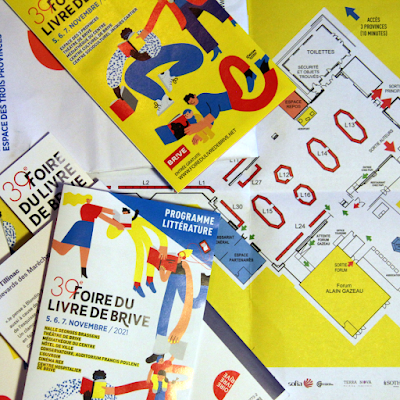
The Foire du livre de Brive and the École de Brive.

The posters,bookmarks and leaflets were reprinted, the stickers had a whiff of ‘country’ this year. ‘ Ce qui nous unit tous les cinq n’est...