Showing posts with label Les-Plus-Beaux-Villages-de-France. Show all posts

Saturday, July 31, 2021

La Vicomté de Turenne: Autoire.

Autoire deserves its “Plus Beaux Villages de France” label.
In descending from the plateau by the precipices that edge them, one is suddenly transported from parched wastes to pleasant pastures... Above, on that stone table, are wind, cold, nakedness, poverty, moroseness, hideousness, - a void, for few villages are found aloft; below, orchard land, warmth, gaiety, abundance. The startling contrast between some of the cañons and their causses forms one of the most phenomenal beauties of beautiful France.

Wrote Sabine Baring-Gould (an Anglican priest, antiquarian, novelist, folk song collector and eclectic scholar), in his 1894 book: The deserts of Southern France: an introduction to the limestone and chalk plateaux of ancient Aquitaine. He found the causses to be ‘veritable deserts: in winter a Siberia; in summer a Sahara…’
Nestled at the bottom of the forested valley is the village of Autoire.
A year earlier (1893), compatriot Edward Harrison Barker, wrote in his book; Wanderings by southern waters: Eastern Aquitaine, after taking his ‘sheep-track up the arid steeps’:

And yet, when I looked down into the bottom of this steep desert of stones, what soft and vernal beauty was there... just as if that strip of meadow, with its gently-gliding river, had been lifted out of an English dale and dropped into the midst of the sternest scenery of Southern France.
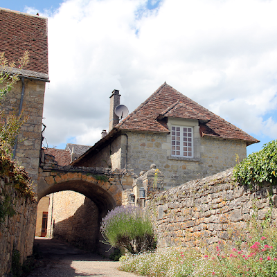
Autoire can be explored through small alleyways.
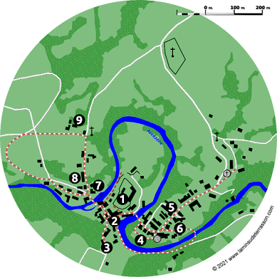
Sadly the ‘epoch when everyone travels’ is over, but the modern day tourist can nowhere experience the contrast between the plateau and the valley easier than by hiking the Autoire ‘cirque’ (circus) with its 150 to 200 m high limestone cliffs. Shaped by the Autoire stream, grinding its way into the limestone plateau of the Causse de Gramat through a 30 m high waterfall (7). Beautiful and impressive, this majestic waterfall is the first highlight on a 3 km (2 hour) walk. On your way to the waterfall, stop at the Chappelle Saint-Roch (6) and have a quick look at its frescoes through the grilled window.
The 30 m high waterfall.
From the waterfall a steep climb brings you to a viewing area (8) on the edge of the cliff with great panoramic views of the valley and waterfall. The hamlet of Siran is home to a farm managing a flock angora goats. The descend passes the Château des Anglais cliff-castle (9), a medieval construction enclosing a overhang in the limestone cliff. Long the home of ‘brigands’, it has commanding views and is naturally protected on all sides, a closer inspection reveals it is basically a facade, only two meters deep at the interior.
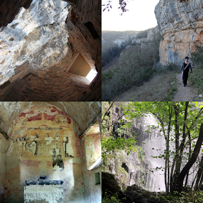
Hiking the Autoire ‘cirque’.
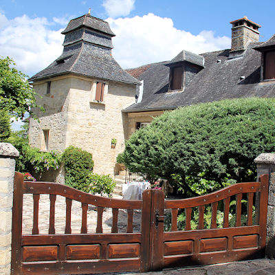
Nestled at the bottom of the forested valley is the village of Autoire with its elegant manor houses flanked by turrets, mansions, castles and half-timbered houses. The Romanesque church of Saint-Pierre et Saint-Paul (1) was rebuilt by the end of the 11th and beginning of the 12th centuries. It was fortified towards the end of the Hundred Years War, and the bell tower was raised. Covered with a cupola it has interesting sculpted decorations.
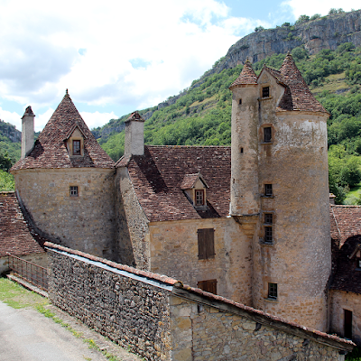
Elegant manor houses flanked by turrets, mansions, castles and half-timbered houses.
The Fontaine aux Dauphins (2) build by ‘voluntary contributions’ takes center stage, pass l’ancien couvent (3) and the Chateau de Limargue (4) that obtained the right to build towers and machicolations after its owner was knighted by King Charles VIII. The door at the bottom of the tower is adorned with a toric arch carved in an accolade, typical of the late 15th century. The second tower, more imposing, served as a defense tower.
Map of Autoire and its hike.
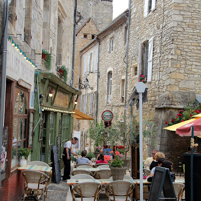
The Manoir de Laroque-Delpratas (5) deserve special mention; owned by a bourgeois family since 1605 (judges, notaries, lawyers), it preserves its 17th century characteristics: L-shaped plan, stairwell, large windows and decorated skylights. Small restaurants, and shops promoting local art and gastronomy, can be explored through small alleyways. Autoire deserves its “Plus Beaux Villages de France” label. Find out more about the landscape, history, vegetation, the villages and life on the causse:

 The index of this blog.

Monday, July 26, 2021

The Vézère Ardoise: Saint Robert

One of three fortified gateways of Saint Robert.
Strategically located at the top of a limestone plateau, the fortress, the ramparts and fortified towers of Saint Robert still impress today.
The pilgrimage church of Saint Robert with its apsidal chapels.
The pilgrimage church of Saint Robert (1) is at the center, a listed historic monument since 1862, and worth a visit. The Church was damaged and destroyed several times over the course of history, then rebuild with new additions.
Detail of the circulation gallery around the chancel.
At some time the nave was broken down, leaving an interesting cluster: the chancel, the ambulatory, transept and apsidal chapels (all 12th century), square towers and an octagonal lookout tower. An ambulatory (circulation gallery around the chancel), allowed pilgrims to kneel in front of relics kept in the apsidioles.
The panoramic view of the landscape from the rampart.
Make sure not to miss the garden in the left of the church down the stairs with a panoramic view of the landscape from the rampart (2).
Pigeon's loft along the village walk.
Pigeon's loft a[ong the village walk.
The village is build out of local limestone and a short walk passes a 16th century chapel (3), three fortified gateways (4), a pigeon's loft (5) back to the central place with its wrought iron cross full of symbolism (6), the Beauroire manor (7), ancient mansion (8) and the 12th century monastery (9).
Map of Saint Robert.
Find out more about the landscape, history, vegetation, the villages and life on the causse:

 The index of this blog.

Sunday, July 18, 2021

The Vézère Ardoise: Ségur-le-Château

Located in a loop of the Auvézère.
Located in a loop of the Auvézère, Ségur-le-Château is, as its name suggests, a secure place, that was chosen by the 9th century feudal Viscounts of Limoges to build a castle. The city of Ségur remained the seat of the Viscounts of Limoges for six hundred years. Though Ségur never was the actual capital of the Viscount the lords resided here regularly, attracting families of knights-vassals and a number of officers.
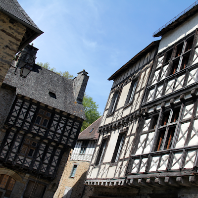
Beautiful group of 15th century half-timbered houses.
During the Hundred Years War, the fortress of Ségur was occupied by the English between 1361 and 1374, then confiscated by the king of France it became a royal stronghold. At the junction of the County of Périgord and the Viscounty of Limoges, the headquarters for the Court of Appeals was installed, rendering justice over hundreds of lordships of the Périgord and Limousin.
Restauration during the off-season.
This Court of Appeals functioned as a first appeal between the ordinary seigniorial justices and the Royal Parliament of Bordeaux. This explains the large number of quality noble houses and hotels dating back to the 15th and 16th centuries in this out of the way corner that today seems to be located in the middle of no where. In 1750 the Court of Appeals was suppressed by an edict of the king and the bourgeois families left Ségur little by little. In 1795, the castle was bought by Hautefort.
Map of Ségur-le-Château.
The ruins of the castle (1) and its outer walls overlook the scene. The place and rue des Claux’s beautiful group of 15th century half-timbered houses (2), exquisite mullioned windows (stone window bays with crosspieces), a small alley taking you up to a group of 15th century sculptures adorning the Saint Anne well (3).
Alley taking you up to the Saint Anne well.
A bridge connects to the Place du champ de foire (4) from where you can explore the Place Jean de l’Aigle (5). With its 15th century former presbytery with a cork screw staircase in the tower, on the left in the impasse you find another ancient manor with tower. Walk to the church or pass the 15th century Maison des Appeaux (6) on your way back. A small pedestrian bridge will help you cross the river to the main road for splendid views on your way back.
Bridge next to the watermill.
Cross the Place des Claux and find another bridge next to the watermill leading to the circular flamboyant Gothic styled Saint-Laurent tower (7) with its mullioned windows (15th century). On the other side of the road a hotel adorned with a square tower from the same era (8). A little walk takes you to the Domaine du Chédal (9) dating from the 17/18th centuries with a large landscaped park labeled jardin remarquable (visits only in group and by appointment during summer). Find out more about the landscape, history, vegetation, the villages and life on the causse:

 The index of this blog.

Wednesday, April 21, 2021

Coly valley hikes: Saint Amand de Coly

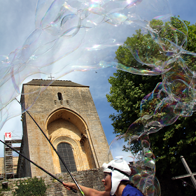
Cultural activities throughout summer.

Cultural activities throughout summer.

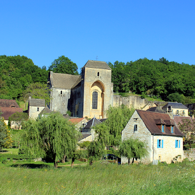
The village of Saint-Amand-de-Coly is classified as one of 'France's most beautiful villages'. According to the legends, sometime halfway the 6th century, during the reign of king Clovis I, a young noble man from the Limousin arrived to accept a monastic life. Amand followed Sore and Cyprien to the Merovingian monastery of Genouillac (now Terrasson) and after a long stay there, the three 'saints to be' decided to separate and live as solitary hermits. Amand found a cave not far from Genouillac in what was to become Saint-Amand-de-Coly.
Flowers popping up in the landscape.

Flowers popping up in the landscape.

During his life Amand evangelized the local population whom declared him a saint. After his death a monastery and village grew around his grave. The first known historic document referring to the monastery dates from 1047. Though there is mention of destruction here by Normans in 857, the year the Saint Sore monastery of Terrasson was plundered and raised to the ground. In 1101 it is decided to hand the monastery of Terrasson to the Benedictine order, prompting a core group of the monks to leave for Saint-Amand, where they established a Augustinian order.
Cultural activities throughout summer.

Cultural activities throughout summer.

We now enter the middle ages with its own wars and ravages. The construction of the outer walls was probably started during the 100 year war, it was during the wars of religion that the protestants sacked the monastery and sought refuge in 1575, when canons had to be brought from Brive to chase them out. Some of the resulting holes in the walls are still visible today. It was during this time the tomb of Saint Amand was destroyed.
The fortified church dominates the village.
The monastery becomes the milking cow of the Sauvebeuf family whom milked it dry for 182 years at the end of which little more then a ruin remained, by 1738 only three monks are left. After the revolution all monasteries were nationalized and sold-off, the village is renamed Amand-le-Vallon. The abbey church became the village church but it not till 1886 some serious restoration work starts.
Map of Saint Amand de Coly
Map of Saint Amand de Coly.
Sights
With a total depth of 48m, width of 27m and height of 8m the impressive fortified church dominates the village. The construction took most of the 12th century. Based on a Latin cross layout, oriented east-west. The defense walls measure 300m and enclose an area of 5000m2. The church was converted into a fortress but despite its additional defenses it remains a beautiful Romanesque church with simple lines and a simple interior. Its defenses include very thick walls, exits for archers and several blind staircases.
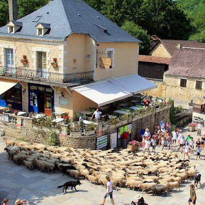
Transhumance passing through the village.

Transhumance passing through the village.

The historical walk of about 1km starts by exploring the church (1), the guardhouse (2) and the defense walls. It then explores the heritage of the village; the former drying shed for tobacco (3; now community hall), the drying shed for wallnuts (4;now tea room), the 'romanesque house' (5), the village well, the presbytery, the former hospital (6) and its washing area. The walk then provides some good views of the village (7), before returning. Alternatively there is a 2,5km 'nature trail' (8) close to the village. Find out more about the landscape, history, vegetation, the villages and life on the causse:

The index of this blog.

Saturday, March 20, 2021

La Vicomté de Turenne: Collonges-la-Rouge.

View through the 15th century gate.
The village headquarters the french association of the Plus Beaux Villages de France, created by its mayor in the 1980's. The Rouge (red) in its name refers to the red sandstone that was used in the construction of the village. Formed millions of years ago the stone is found naturally to the north of the village. The deep red color, that becomes especially contrasting with the green hillsides after rain, is caused by the iron oxide within the stone.
Well preserved streetscapes in a deep red color.
A first church was build here in the 8th century and Collonges-la-Rouge developed into a prosperous little town with six 'chateaux' and became a renowned wine producer, till the Phylloxeria epidemic wiped out the vines in the 19th century. The village switched to the production of walnut and walnut oil. The population dwindled from almost 2000 in the 16th century, to just 500 hundred today.
Map of Collonges-la-Rouge.
During 1930's the architectural integrity of the village became protected and restored including the church, mansions, castles, houses and pilgrim’s hostels. As a result, it is possible today to walk through the 15th century defense wall gates and well preserved streetscapes in a deep red color.
Detail local artisan shop.
A visit to the Saint Pierre church (3) will puzzle you with a wealth of symbolism and a quite unique 'double nave', that divided the church for use by the two different 'cults'. The green in the colored glass windows contrasts with the red walls, and a sky-well illuminates the center.
Halle with four banal.
Walk through the village and admire the Castel de Maussac (1), Castel de Vassinhac (2), Halle and four banal (4), Maison Boutang du Peyrat (5), Castel de Benges (6), Maison de la Sirene (7), Manoir de Beauverie (8) and the Town hall (9) along the way. Find out more about the landscape, history, villages and life in the Vicomté de Turenne through:

The index of this blog.
Sunday, March 14, 2021

La Vicomté de Turenne: Turenne.

Table mountain of Turenne.
The table mountain of Turenne has been attractive for its natural defensive position, fortifications date back to the 8th century when it became the center of the Carolingian land of Tornés, over time giving birth to the Vicomté de Turenne.
Map of Turenne.
Map of Turenne.
After the reformation Turenne became a protestant stronghold becoming a safe-haven for protestant artisans, continuing to enjoy a privileged position well into the 18th century, when it became the property of Louis XV and the catholic Notre-Dame-et-Saint-Pantaléon church (7) was reconstructed.
Turenne seen from the castle.
After the revolution the castle and defence works were largely dismantled, leaving the round tower of Caesar (1) and square donjon (2) ornamenting the plateau, whiles scattering stones and ornaments are across the village.
View from Caesar's tower.
Walking around you will spot windows, doors, cornerstones and statues ornamenting unexpected places. The Capucines chapel (3) hosts exibitions in summer and has a metal viewpoint sticking over the 13th century defence wall.
Port de la ville.
Port de la ville.
Walk through the port de la ville (4), find the cazemate du Virage (5) and the tour dite du Calvaire (6) parts of the 16th century defense works. Find out more about the landscape, history, villages and life in the Vicomté de Turenne through:

The index of this blog.

Thursday, March 4, 2021

La Vicomté de Turenne: Curemonte.

Skyline of Curemonte.
Hugging the rocky ridge line overlooking the Maumont and Sourdoire valleys, Curemonte was build on a strategic defensive position. Six towers dominate the skyline build by three lords united to defend the village. One of the lesser known ‘most beautiful villages’ of the Corrèze, with 7 noble houses, 3 castles, 3 churches, a market hall, fountains and other small heritage, this village is really worth a detour.
Map of Curemont.
Map of Curemont.
Most of the buildings visible today date back to the 14th and 15th centuries. Towers, main buildings and the fortified enclosure of the castles of Saint Hilaire and Plas dominate. In the village, the Saint-Barthélemy church, patron saint of Curemonte, was built in the 12th century.
Architectural detail of the castle.
Over time enlarged with a chapel, and a sacristy. In the 17th century, it was decorated with a painted wooden altarpiece which has recently been restored by the Friends of Curemonte into its original polychrome glory.
Local produce direct from the farm.
The rural exodus and First World War affected the village, bringing to population down from 1200 at the beginning of the 20th century, to only 216 inhabitants today. A walk through the village will reveal large architecture and interesting small heritage like the Grotto (1), Noble houses (2), St.Hilaire and de Plas castles (3) and the Saint Bartlelemy church (4).
Summer in Curemonte.
But the real attraction lies in looking back at the village, nested in the surrounding countryside, from the hiking trails. Every season has its charm, with poppies popping out in spring, autumn leaves, and gentile Limousin cattle year round. Find out more about the landscape, history, villages and life in the Vicomté de Turenne through:

The index of this blog.
Friday, February 26, 2021

La Vicomté de Turenne: Martel.

The market 'halle' of Martel
The market 'halle' of Martel.
Driving towards Martel through the barrenness of the causse, seeing a skyline emerge dominated by 7 towers is a clear indication you are approaching a historic place.
La Tour Tournemire
La Tour Tournemire
Martel” (french for ‘hammer’), was the name given to the great Charles Martel in the 700s. Legend has it the “savior of Europe” (and grandfather of Charlemagne), founded this garrison town, after defeating the Muslim forces that took over Aquitaine in 732, to block any future Islamic advance towards northern Europe.
Map of Martel
Map of Martel.
The Palais de la Raymondie (1) at the center of town houses a small museum largely dedicated to the Puy d’Issolud, a Celtic archaeological site (to the west) which has been identified as Uxellodunum, besieged by Julius Caesar in 51 BC, legendary last stand of the Gauls against Roman occupation.
Food served on the streets.
And Martel hosted an Angevine (‘English’) tragedy. When Henry ‘the younger king of England’, took refuge and died here in 1183. So estranged and antagonized from his father, the count of Anjou (and Henry II ‘the elder king of England’) only arrived after his death was confirmed, thinking the scene had been a trap set by his son to catch him.
Doorway with roses
Doorway with roses
The small town is densely packed with history, a weekly farmers market is held in the historic ‘Halle’ (2) every Saturday. Rich in local produce, and seasonal truffles and mushrooms gathered from the surrounding forests and causse. Strolling through the small streets admire the Maison Fabri (3), Hotel de Briance (4), Maison de la Vidalie (5), Hotel de Mirandol (6), Saint-Maur church (7) and La Tour Tournemire (8).
Slow life...
Slow life...
Towards the south of the town you will find the train station from which a steam train plies a historic rail line constructed on the Dordogne river cliff side. Find out more about the landscape, history, villages and life in the Vicomté de Turenne through:

The index of this blog.

The Foire du livre de Brive and the École de Brive.

The posters,bookmarks and leaflets were reprinted, the stickers had a whiff of ‘country’ this year. ‘ Ce qui nous unit tous les cinq n’est...